Tornado warning lifted for parts of Elmore, Owyhee counties, immediate threat over
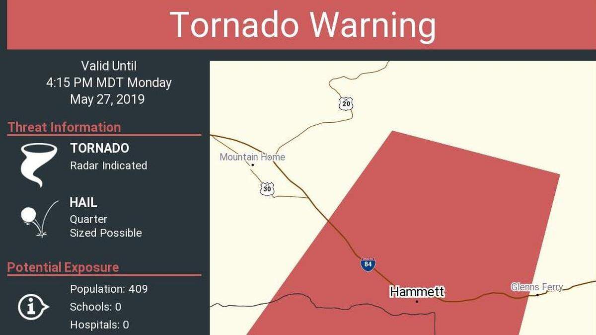
A tornado warning was briefly issued for southeastern Elmore County and northeastern Owyhee County on Monday, according to the National Weather Service, but the immediate threat is over.
At 3:50 p.m., a severe thunderstorm capable of producing a tornado was located near Hot Springs Creek Reservoir, or 10 miles northwest of Glenns Ferry, moving south at 15 mph. Quarter-sized hail was expected.
“Flying debris will be dangerous to those caught without shelter,” according to the weather service. “Mobile homes will be damaged or destroyed. Damage to roofs, windows and vehicles will occur. Tree damage is likely.”
By 4:30 p.m., the warning was lifted and the weather service reported that “the storm which prompted the warning has weakened below severe limits and no longer poses an immediate threat to life or property.”
Severe thunderstorm warnings will remain in place for the Twin Falls area and parts of Elmore County, about 20 miles southeast of Glenns Ferry. Wind gusts are expected to reach 60 mph and hail is expected, according to the NWS.
This story was originally published May 27, 2019 at 4:08 PM.