
New Bogus Basin trail provides big views without huge climbs
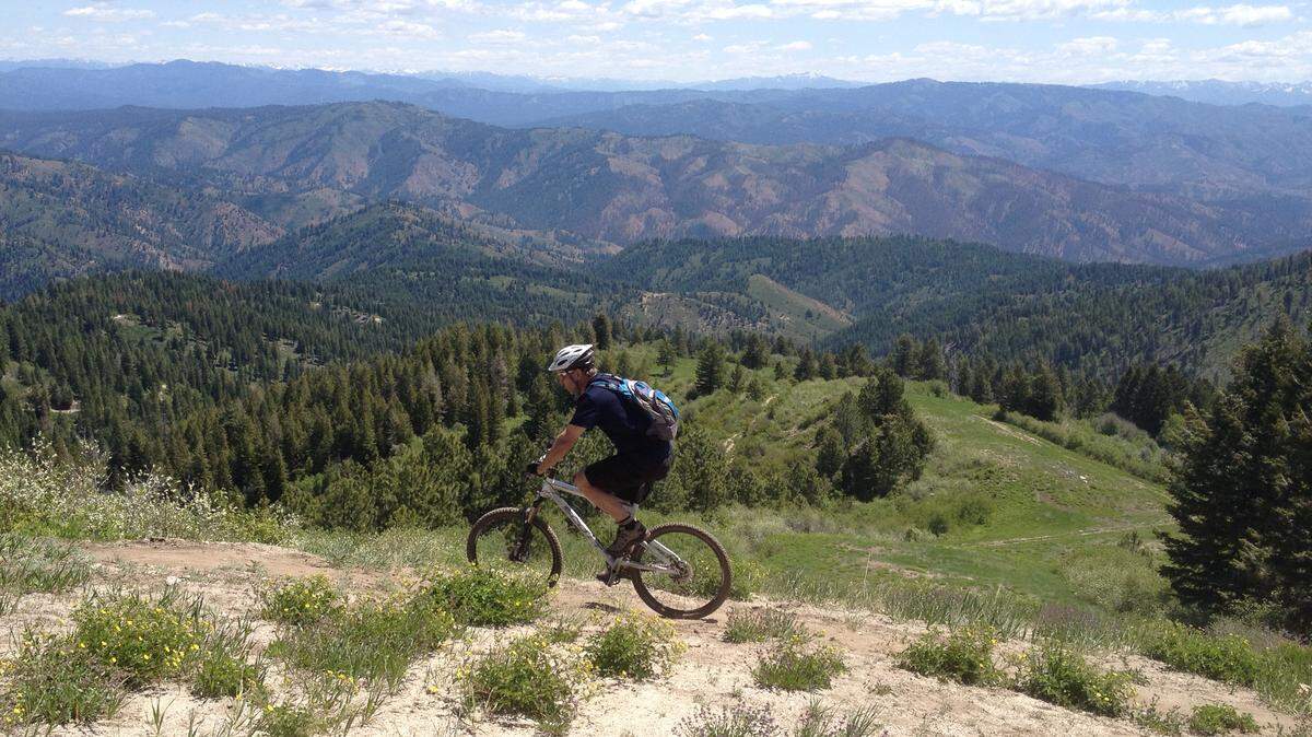
If you haven't ridden this trail yet, you really have no excuse. It's cool at Bogus Basin, and this trail is suitable for most mountain bikers with intermediate bike-handling skills and reasonable fitness.
Even if it's a bit of a challenge, it's worth the effort because the Around the Mountain trail gives you access to wonderful mountain scenery without huge, tiring climbs.
The trail was completed last fall, and while many associate it with the resort, it's actually a Ridge to Rivers trail that was built for about $100,000 through a grant from Idaho Parks and Recreation with matching money from Ridge to Rivers.
It was built with mountain bikers in mind, but it's open to all non-motorized users, so you may encounter hikers or horses on this trail.
Mountain bikers have flocked to this trail, but some may be intimidated by it, or just haven't gotten around to it yet.
To give you a better guide of what it's like to ride this cool mountain trail, I've broken it into sections so you know what you'll experience, along with mileage and elevation changes.
The names of these sections are my creations, so don't expect to see them on signs or on a map; they're just a handy guide to let you match mileage with landmarks so you know how far you've gone and what's ahead.
My ride was measured with the Strava app on my iPhone, and it's common for mileage to vary by a few tenths of a mile depending on whether you use a phone, GPS, bike computer, etc.
So let's take a ride Around the Mountain:
ENTRANCE EXAM
Mile 0 (6,100 feet elevation)
Start on the Deer Point Trail in front of Simplot Lodge near the quad chairlift of the same name.
It's not officially part of Around the Mountain Trail, but it's how you access it.
You're climbing most of the way, and part of it is in the sun, which always feels hotter. You're also starting your ride at higher elevation than the Valley, so it may feel a little more strenuous.
Don't freak out. It's a challenging climb for most riders, but there have been hundreds of people of all ages and skill levels who've done it, so you probably can, too.
But if you're exhausted by the time you reach the Around the Mountain trailhead sign, you may want to rethink this ride.
The good news: It's all downhill back to the parking lot where you started.
Mile 1.1 (6,400 feet)
Congrats. You've made it to Around the Mountain trailhead. You can't miss the sign on your right, where the trail splits from the Deer Point Trail.
The climbing isn't over when you reach the trailhead. You're going to hit a few steep spots with some tight switchbacks. It's good practice, but if it exceeds your climbing ability, don't lose hope. Get off and walk, and you will be back on your bike in no time.
Mile 1.9 (6,600 feet)
The longest continuous section of climbing is over when you reach Shafer Butte Road. There are gates on each side of the road.
The climbing is now shorter sections paired with matching descents as you are riding undulating, sidehill terrain. This stretch is what most of the trail will be like.
Watch those outside corners. They're loose and can wash out your front tire. Also expect a few rocky, technical sections that keep things interesting and make this trail a little more technical than most trails in the lower Foothills.
Mile 2.5 (6,600 feet)
You're crossing Boise Ridge Road. For better or worse, you're now a quarter of the way through your ride.
DOWNHILL NIRVANA
Mile 3.3 (6,600 feet)
If you love riding fast downhill, this is your section. The trail pitches downward and drops about 300 vertical feet through a series of tight, bermed corners that will either have you in gravity nirvana or a little freaked out.
If you're freaked, don't fret. Riding berms is an art you can quickly learn. Get into an aggressive riding stance. Look as far you can through the corner. It's critical you look down the trail as far as possible. Where your eyes look, your bike will usually follow.
It also gives you the confidence of knowing what lies ahead.
Remember, riding downhill is a skill that must be learned. Don't just sit on the seat and ride passively.
Stay loose while descending. White-knuckling the handlebars and riding the brakes while stiff-armed makes it harder to keep the bike under control.
Relax and remember gravity and momentum are your friends. Use them wisely.
BACKSIDE OF BOGUS
Mile 4.6 (6,300 feet)
Whew! That downhill section is a blast. You're now back in familiar territory if you're a skier or snowboarder.
You're on the backside of Bogus near Upper Nugget run and crossing another part of Shafer Butte Road.
Don't go downhill. Cut across the slope to where the trail continues. There's a sign marking the trail.
Take a break, grab a snack and a drink of water. Enjoy the views. It's beautiful up there, and you can see a long way to the east toward Idaho City.
When you're refreshed, it's time for more climbing, and some of the most scenic stretches of the trail.
You will only gain 100 feet in elevation, but don't let that fool you because it's more undulating terrain with several short, moderately-steep climbs.
You are also on some exposed slopes where the direct sunlight once again makes it feel hotter than it is.
There are a couple small creek crossings where you can splash cold water on your forehead and cool off.
Mile 5.4 (6,400 feet)
You will pass under the Pine Creek Express Chair. Relax, climbing may be challenging, but it's nothing you can't handle. You're also more than halfway through the ride. Stop often if you need to and enjoy the views. Just a little more climbing to go on this section.
Mile 5.6 (6,500 feet)
You will cross another access road that's also a ski run. Look below, and you will see a timing shack for ski racers.
MINI DOWNHILL - INTO THE WOODS
Mile 6.6 (6,600 feet)
When you hit a small section of an access road/double track/ski run, you get to reap more gravity rewards.
You will pick up speed as you descend on rolling terrain and find a couple more banked corners. You will also encounter a few rocky, technical sections, including a rock bridge.
If you feel uncomfortable, walk these sections, but remember they are designed for a mountain bike to ride over them with a little momentum and moderate bike handling skills.
Give them a good look and vow to ride them next time if you decide to walk this time.
Mile 7.5 (6,500 feet)
You cross under the Superior quad chair, and you're rounding around the backside toward the front of the mountain.
FINAL EXAM
Mile 7.8 (6,600 feet)
When you hit the double track, you're a half-mile away from Pioneer Lodge.
If you're tired, drop into your granny gear and spin up this steady climb to the top of the Morningstar Chair.
Enjoy the views into the Horseshoe Bend area.
If you feel sapped of energy at the end of the trail, don't worry, you should be. You rode more than 8 miles of mountain single-track trail.
When you get to the top of the Morningstar Chairlift, you've reached the end of Around the Mountain trail.
If you're bushed, you can take an access road back to the lower parking lot by riding dirt roads, or the paved road from Pioneer Lodge down to the Simplot Lodge parking lot. But wait ...
EXTRA CREDIT
Mile 8.3 (6,800 feet)
Trust me, you want to keep riding single-track; you're a mountain biker, after all.
When you reach the top of Morningstar Lift, cross underneath it and ride the dirt road that goes by Pioneer Lodge (don't drop down the access roads on the left) and follow the road two tenths of a mile.
Go past the sign that says "Silver Queen" and watch for the Morningstar Trail sign on your left.
There's another two miles of tight and twisty, downhill single track that ends near Simplot Lodge.
Watch your speed, and beware that the technical difficulty on Morningstar Trail is a little higher than Around the Mountain.
You will also see several raised wooden ramps that add to the challenge. They all have ride-around options if you stay on the trail.
The ramps aren't technically difficult, but the penalty for error is high if you fall off. Use your best judgment.
Mile 10.3 (6,100 feet)
You're now back at Simplot Lodge.
If it's a weekend, enjoy a burger and a cold beverage on the deck.
You've earned it.
Roger Phillips: 377-6215, Twitter: @rogeroutdoors
This story was originally published August 28, 2014 at 12:00 AM.